- News
- Reviews
- Bikes
- Components
- Bar tape & grips
- Bottom brackets
- Brake & gear cables
- Brake & STI levers
- Brake pads & spares
- Brakes
- Cassettes & freewheels
- Chains
- Chainsets & chainrings
- Derailleurs - front
- Derailleurs - rear
- Forks
- Gear levers & shifters
- Groupsets
- Handlebars & extensions
- Headsets
- Hubs
- Inner tubes
- Pedals
- Quick releases & skewers
- Saddles
- Seatposts
- Stems
- Wheels
- Tyres
- Tubeless valves
- Accessories
- Accessories - misc
- Computer mounts
- Bags
- Bar ends
- Bike bags & cases
- Bottle cages
- Bottles
- Cameras
- Car racks
- Child seats
- Computers
- Glasses
- GPS units
- Helmets
- Lights - front
- Lights - rear
- Lights - sets
- Locks
- Mirrors
- Mudguards
- Racks
- Pumps & CO2 inflators
- Puncture kits
- Reflectives
- Smart watches
- Stands and racks
- Trailers
- Clothing
- Health, fitness and nutrition
- Tools and workshop
- Miscellaneous
- Buyers Guides
- Features
- Forum
- Recommends
- Podcast
TECH NEWS
 os maps 2.png
Ordnance Survey releases most detailed mapping app yet
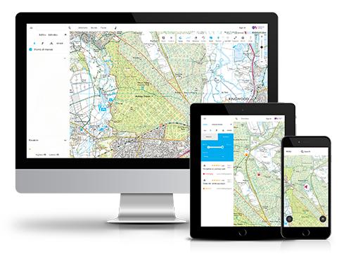
If you’re planning a cycling route you need high-quality maps, and Ordnance Survey has just released its most detailed mapping app yet, which is freely available on iOS and Android smartphones.
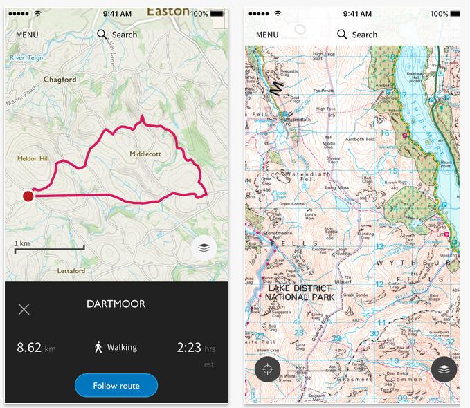
Called OS Maps, the new mapping app is aimed at cyclists (as well as walkers, runners, mountaineers and outdoor adventurers) and is available through a website and smartphone app. The app comes preloaded with 500,000 routes.
The app is free to use, but a subscription service unlocks a suite of extra features. What extra features you ask? You can access 607 Explorer and Landranger digital maps, and each of the 15 national parks, providing complete and total coverage of Great Britain. A one-month subscription costs £3.99 and 1 year is £23.99.
These maps will also be available offline, so you don’t need to burn through your available data or even have any mobile phone reception, and it uses the GPS feature of most smartphones to track your location.
Ordnance Survey has thoroughly tested the new app, releasing it as a beta last year during which time it has been used by over 750,000 people with lots of feedback providing improvements that have been incorporated into this official release.
“Over the past decade we’ve seen digital mapping in general come a long way, but as soon as you venture away from urban spaces the detail is lacking. That lack of detail limits possibilities and also presents a safety problem to anyone that solely uses digital mapping to navigate their way through the countryside,” says Nick Giles, Managing Director of Ordnance Survey Leisure.
“With OS Maps, we wanted to create a digital map that has the same high standards in detail and design as our paper maps. The aim has always been to make the great outdoors enjoyable, accessible and safe, and I think OS Maps achieves this and will help more people #GetOutside and get more from their adventures in this fabulous country.”
You can view the desktop version of OS Maps here, download it for iOS 8 and Android. Right, we're off to download the app and have an explore of our local, and not-so-local, area.
- 19 of the best smartphone cycling apps for iPhone and Android
David worked on the road.cc tech team from 2012-2020. Previously he was editor of Bikemagic.com and before that staff writer at RCUK. He's a seasoned cyclist of all disciplines, from road to mountain biking, touring to cyclo-cross, he only wishes he had time to ride them all. He's mildly competitive, though he'll never admit it, and is a frequent road racer but is too lazy to do really well. He currently resides in the Cotswolds, and you can now find him over on his own YouTube channel David Arthur - Just Ride Bikes.
Latest Comments
- ubercurmudgeon 31 min 2 sec ago
Some quotes need to be put around the word "reciprocal" in the first paragraph.
- David9694 1 hour 7 min ago
this one is wide open for puns, come on people.
- BikingBud 1 hour 7 min ago
Do you mean this woman, who got out to marshall the truck through and is now walking back to said Wankpanzer which is blocking the road again as it...
- mark1a 1 hour 22 min ago
This simply isn't true. I've been running radar lights for 10 years now. I cycle mostly on rural roads, I get notified of approaching vehicles up...
- Rendel Harris 3 hours 52 min ago
Genuinely puzzled as to how you've extrapolated that from what I said. Care to explain?
- Pub bike 6 hours 3 min ago
He is up against the global trading system, which has obviously been in the news a lot lately. Framebuilders in other countries can undercut him,...
- rookybiker 18 hours 30 min ago
The trailer seems to connect to both ends of the rear axle. Can it do tight corners without dragging the tyre sideways?
- Destroyer666 19 hours 26 min ago
Have you owned Bont shoes? In my experience even the widest Lake shoes have had a bizarre form of narrowing way too much in the toe area. But the...

Add new comment
10 comments
An annual subscription can also be bought with £8 worth of Clubcard vouchers.
So, with OS Maps you can import a GPX route, and overlay it onto the map .. Creating your own route its just not as as slick as RideWithGPS, no snapping to roads / cycle paths.
I tend to plan on RideWithGPS, export to GPX, import onto the OS Maps site, and use that when I'm out..
Offline OS Maps on an iPhone/Android is really great, but its not ViewRanger.
I haven't found an option to export routes out of it yet .
Desktop version is hopeless - pretty much everything other than looking at a dumbed down map you have to pay for. Don't bother. OS is all about the money and getting you to pay for the same thing over and over and over again. Bought the whole of the UK from ViewRanger a few years ago - superb. I'd love some way to get better aps onto ny Edge 1000 - even the talkytoaster OSM isn't that good. Full OCM would be ideal.
Big turn off for me is the subscription model. I want to be able to just buy maps for the areas that interest me for a one off cost, not have a rolling monthly bill which will quickly end up costing a lot more.
There is a rather good Android app called Maverick which allows access to the OS maps on a tile-by-tile basis anyway.
Can these be loaded onto an Edge 1000 to get turn by turn directions?
I've been converting Google maps using http://www.gpsvisualizer.com/convert_input
But it splits the routes up depending on how many waypoints I've created (ie. deviations from the set route), which is massively annoying. Using Garmins own map on the device itself is clunky. RidewithGPS is good supposedly but you have to pay to get turn by turn.
Never done it that way, as used these instructions for OpenStreetMap -http://www.dcrainmaker.com/2013/05/download-garmin-705800810.html
So £23.99/year, or £90 with Viewranger to buy the entire country, forever. Or considerably less to buy blocks of the country.
I've had Viewranger since they launched, and it's only got better and better. And you can download and save Open Streetmaps, OpenCycle maps etc, for anywhere *in the world*.
Fabulous value, that.
This will need to be pretty special to come close to the latest version of the Viewranger app.
Looks like a massive improvement over the previous OSapp, which was utterly rubbish. However the reviews on the Google app store are pretty mixed. I notice that you can't yet use routes that others have made on the Android app, only the desktop version. That will be a big improvement. The default map layer looks fine for road cycling, but no good for off road. I don't think there are any routing features but it's fine for seeing where you are.
Although the interface is far less slick, I think Cyclestreets is far more user to the average cyclist, and the maps are free: https://play.google.com/store/apps/details?id=net.cyclestreets
I use OSMand which uses Open Street Maps data...