- News
- Reviews
- Bikes
- Accessories
- Accessories - misc
- Computer mounts
- Bags
- Bar ends
- Bike bags & cases
- Bottle cages
- Bottles
- Cameras
- Car racks
- Child seats
- Computers
- Glasses
- GPS units
- Helmets
- Lights - front
- Lights - rear
- Lights - sets
- Locks
- Mirrors
- Mudguards
- Racks
- Pumps & CO2 inflators
- Puncture kits
- Reflectives
- Smart watches
- Stands and racks
- Trailers
- Clothing
- Components
- Bar tape & grips
- Bottom brackets
- Brake & gear cables
- Brake & STI levers
- Brake pads & spares
- Brakes
- Cassettes & freewheels
- Chains
- Chainsets & chainrings
- Derailleurs - front
- Derailleurs - rear
- Forks
- Gear levers & shifters
- Groupsets
- Handlebars & extensions
- Headsets
- Hubs
- Inner tubes
- Pedals
- Quick releases & skewers
- Saddles
- Seatposts
- Stems
- Wheels
- Tyres
- Health, fitness and nutrition
- Tools and workshop
- Miscellaneous
- Tubeless valves
- Buyers Guides
- Features
- Forum
- Recommends
- Podcast
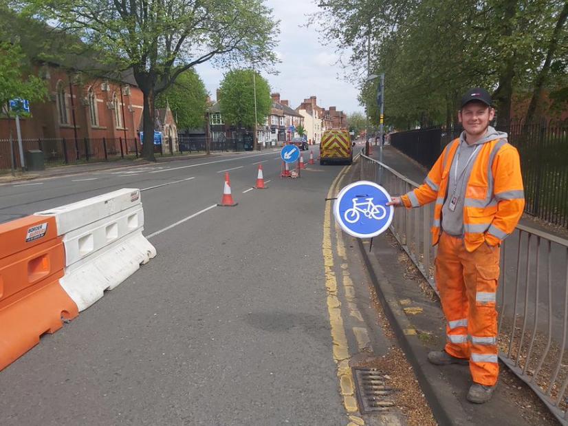
 Leicester bike lane for key workers (via Cllr Adam Clarke on Twitter).PNG
New mapping tool identifies top priority locations for new cycle routes
Researchers have launched a brand-new mapping tool today identifying ‘top priority’ potential protected cycleways across England, to help local authorities bid for and prioritise government cycle funding in an evidence-based way – and citizens can get involved by suggesting where they want routes to be.
The Rapid Cycleway Prioritisation Tool (RCPT), commissioned by the Department for Transport (DfT) and Sustrans, identifies roads with the highest cycling potential – those that can carry the most cycling trips, as well as those with enough width to accommodate new protected cycleways.
The government announced a £250m Emergency Active Travel Fund for cycling and walking infrastructure in May for councils to help people avoid public transport with COVID-19 still at large. While some local authorities in England already have long-term plans for cycle routes they can fast-track, many don’t. Researchers say this tool, based on open data and code, can help identify locations for cycleways to help get the most people cycling.
The RCPT was produced by Dr Robin Lovelace and Dr Joey Talbot at the University of Leeds' Institute for Transport Studies. Dr Lovelace says: “The updated statutory guidance on road space reallocation from the DfT creates a question for transport authorities that our tool can help answer: which roads should be prioritised for road space reallocation schemes?”
While the first tranche of the Emergency Active Travel Fund is for pop-up schemes, the expectation for tranche 2 is that money goes towards more permanent schemes.
Lovelace said of the tool: “Vitally, it allows potential road space reallocation schemes (pop-ups for short) to be ranked in various ways, primarily by cycling potential. That will support local authorities to select the roads that will make the biggest difference for investment as part of Tranche 2 of the Emergency Active Travel Fund, alongside other sources of evidence and local knowledge.”
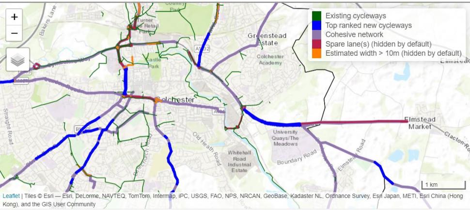
Rapid Cycleway Prioritisation Tool detail - Colchester
In Leeds, Kirkstall Road was identified as having ‘spare space’ and is part of plans by Leeds City Council for a trial cycleway. Lovelace says identifying such space for trials “will help ensure cycleways can become permanent, maximising long-term benefits.” In London, the street with the greatest unmet demand for cycling is Brixton Road.
A56 Chester Road in Stretford reallocated by @TraffordCouncil ~ main artery between M60 & Manchester City Centre. pic.twitter.com/7yWzYzPgeE
— Julie Ryan (@JulezRyan) June 7, 2020
The RCPT uses Propensity to Cycle Tool data, produced by Leeds and other universities, which estimates commuting and school trips that could be cycled under different hypothetical conditions, including in the event of a Dutch-style cycle network, and the government's target to double cycling levels - taking into account things like distance and hilliness. The RCPT provides an interactive map for every transport authority in England, with top ranked new cycleways, as well as what researchers say in many places are ‘disjointed or variable’ existing cycleways. Wales and Scotland have devolved transport authorities so are not included.
As well as top priority routes the RCPT also identifies where a ‘cohesive network’ could be created, regardless of street width, using measures such as ‘filtering’ streets – i.e. closing to through traffic but permitting through cycling and walking trips and maintaining resident access.
“It's a completely open tool and people can download the data. Lots and lots of local authorities will likely end up using it,” says Lovelace.
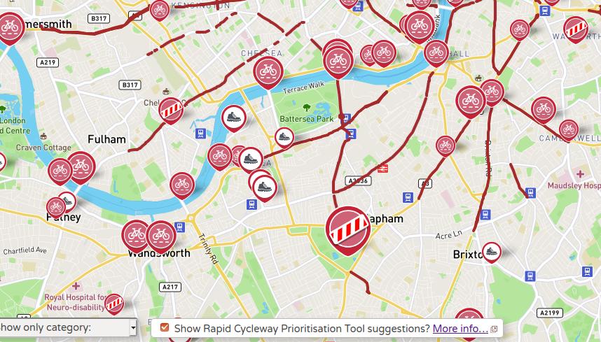
RCPT with Widen my Path
The data has also been added to Widen my Path – a Cyclestreets-based tool to help identify where pavements need widening for social distancing – which means people can have input on where they believe cycle routes should be.
Lovelace told road.cc: “I strongly believe that transparency leads to better decision-making, and hopefully the open data element will help encourage evidence-based investment in pop-up cycleways.”
Laura Laker is a freelance journalist with more than a decade’s experience covering cycling, walking and wheeling (and other means of transport). Beginning her career with road.cc, Laura has also written for national and specialist titles of all stripes. One part of the popular Streets Ahead podcast, she sometimes appears as a talking head on TV and radio, and in real life at conferences and festivals. She is also the author of Potholes and Pavements: a Bumpy Ride on Britain’s National Cycle Network.
Latest Comments
- Secret_squirrel 27 min 24 sec ago
Yup - there now. Probably content mgt systems refreshing...
- JoanneH 47 min 6 sec ago
I've just invested in a new bike and it's got 165mm cranks, which were both the crank length associated with the frame size but also what my bike...
- Rendel Harris 47 min 57 sec ago
As one had every reason to suspect, your video proves there is absolutely no justification in the police pursuing this action against you. Your ...
- Smidge69 1 hour 5 min ago
Im not at all happy with these. I have them in 34. The issue is that the rubber is sufficiently soft, tacky (and presumably therefore grippy) that...
- chrisonabike 1 hour 22 min ago
Amen, brother....
- Rendel Harris 1 hour 48 min ago
I really wish the powers that be would station a few security guards in the crowd at big events like the world championships and tell them to grab...
- bensynnock 1 hour 59 min ago
I think they're probably more happy with the 20mph limits and then just driving as fast as they like, as they do currently.
- ACyclingGuitarist 2 hours 36 min ago
I ride to and from Manchester from where I am (just out of Bolton) and the standard of driving you see is shocking, from both a cycling and driving...
- JRogerson 3 hours 12 min ago
I'd be cautious with the £10 per month TNT offering and your expectation of what you'll get. I suspect it will simply be access to the channels....
- The_Ewan 3 hours 23 min ago
If they also have the abilty to switch from dipped to 'full beam' they'd be interesting to know about....


Add new comment
5 comments
I've had a look at the town where I live and it's clear that there was no local knowledge put into deciding what goes into what layer- the main bypass road for the centre is identified as both one on which road space should be switched to bike and one that should be made one way or closed to vehicles completely, the roads identified as being needed to form a coherent network don't link, in most places, to anything pre-existing and most existing facilities are missing, including parts of the ncn
If this is seriously supposed to be used as a tool for identifying future development then it looks next to useless and if funding is to be influenced by choosing routes identified by this tool then, if where I live is typical, cycling will be done great harm.
The big problem I see is that they include the NCRs. Most of those are pretty much unusable for commuting and getting from A to B. Here in Somerset you need a mountain bike with lots of suspension to deal with the surface and power assist to deal with the hills. They sent them down quite roads but they were quiet for a reason.
Not just the NCRs - it seems to assume that anywhere that there's an 'existing cycleway' is not a candidate for priority work. Even if that 'existing cycleway' is an overgrown foot-wide pavement that just happens to have had a bicycle symbol slapped on it.
Well, that tool looks impressive to me. Bristol is covered in lots of blue squiggles whilst Bath only has a couple.
Important phrase is "network". Lots of fragmented improvements would be less than the sum of their parts.